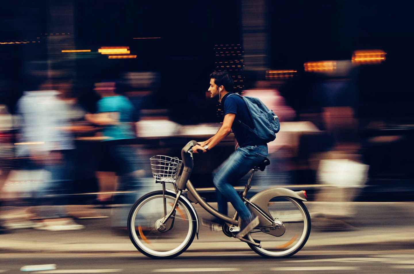
Ottawa is a great city and there are plenty of places to go and explore. If you’re hoping to take advantage of the public spaces and businesses that have recently opened up to us, you should hop on your bike. If you want to take a trip downtown, it’s really easy and safe. If you don’t feel comfortable biking in traffic or want to bike with friends or kids who aren’t strong cyclists, these instructions are for you.
This small series will focus on three destinations: The Byward Market (part 1), Centretown (part 2), and Hintonburg (part 3).
I’ll be using Bike Ottawa’s trip planner, which is a great resource. I’ll also link to Google Streetview, which is handy if you want to get familiar with the layout of something at ground level
Byward Market
A trip to the market is pretty easy. Weirdly the worst part is actually in the market, which is very car-focused (hopefully it changes). It would take me about 25-30 minutes to bike this route depending on lights and how comfortable I want to be.
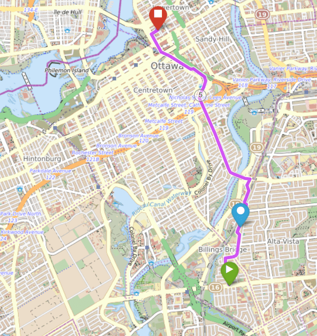
Leaving Heron Park
Assuming you start out around Clementine, make your way to the intersection of Bank and Belanger/Lamira.
Entering Alta Vista
Go through the intersection at Bank onto Lamira. Go past the little strip mall and the church, and straight through the roundabout. You’ll bike down a nice street with trees on either side, followed by several large houses. Lamira ends at a path, which you take through to Pleasant Park. Cross the street when it’s safe and continue straight onto Rodney Crescent. After only 100 metres, you’ll see a pathway on your left over the rail tracks. Take this pathway. You might need to hop the curb, or go a little further down the street to the sidewalk ramp.
Riverside Hospital
The path over the tracks leads to a small road that goes beside Riverside Hospital. Continue straight from the path. When you continue straight beside the hospital, you’ll eventually arrive at Smyth Rd. If you position yourself in the turning lane over the three yellow dots on the road, the traffic lights will sense you, and change for you. Turn left onto Smyth and onto the bike lane on the bridge (note that the bike lane doesn’t start right away, but there’s still enough room for you on the right hand of the road – link to a streetview).
Note: You will have to make sure that you don’t take the off ramp down to Riverside, and that you watch for cars merging onto the bridge. They have to yield to you, but make sure they see you.
Main Street Path
After you cross the bridge in the bike lane, you’ll be on Main St., which has a fully separated bike lane. Take this street all the way down. Just watch out for cars backing out of driveways, and dummies turning into your path. You still need to be aware of bad drivers at all times.
Main to Echo Dr connection
The Main St. bike paths ends under the 417, so that cars can have a dedicated turning lane onto Greenfield Ave. That means that the safest and best place for you is exiting the bike lane and merge left in the left lane, which is the lane that continues straight at the lights. If you would rather walk your bike down the sidewalk for a block and cross at the lights, go right ahead. What you don’t want to do is bike on the right of the road when people will be turning right onto Greenfield and cutting you off.
Once you get through the intersection, there’s lots of room on the right of the road for you, and you’ll want to turn right onto Echo drive almost immediately.
Echo Drive to Path
Echo Drive is a one way north in this section, but bikes can travel both ways. You’ll want to just head straight until you see the path right ahead of you, and take that path. This path is a multi-use path that you’ll share with people walking, skateboarding, standing, etc. Be polite and safe, ring your bell and take it slow when you need to.
This path leads you along Colonel By, and beside the University of Ottawa. If you want to go to Sandy Hill, take a right when you get to the uOttawa LRT station, which is also where the Corktown bridge is. It’s a busy place, so take it slow.
The Canal Path
Cross Colonel By at the light, and take the short path to the canal path, the one that goes alongside the canal. When you reach the canal, go right (north). This path is also a shared path with all sorts of other people, moving fast and slow. Take your time and enjoy the beautiful view without hitting anyone.
This path ends at Daly Ave, in front of the Shaw Centre. From here on out, you’ll have to bike on the road. There are two lanes in each direction so take a comfortable amount of space in the right lane. It’s only for a block. You could also walk if you prefer, or of course lock up your bike and go into the mall.
The Market
Once you cross Rideau Street, you’re technically in the market. Pick your preferred cross street and turn right off of what is now Sussex whenever you wish. In my experience on a bike, George and Clarence are more enjoyable than York.
It would be easier to walk, bike and drive in the market if the city would just get rid of street parking.
There are lots of racks to lock your bike. Avoid street signs if you can. Some of the signs and posts are removable, and the market staff will remove posts if the space is needed for market stalls. If you’ve locked your bike there, they’ll bring it into their offices. It’s happened to me!
Conclusion
To get home, just follow all these directions in reverse. It’s a bit frustrating to get back on the canal path from the market so don’t feel bad if you want to walk there.
Obviously the fastest way would be to bike down Bank to Wellington, but the mayor wants to keep space for some cars to park on Bank. As well, the city chose to make Bank and Wellington major car commuting spaces. This takes away from our ability to actually use the street unless we get into a car. Even then, Bank gets so congested on weekends and during big events, getting in a car doesn’t work either.
Author: Mike Little
